


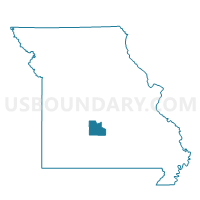
Friendship Voting District, Laclede County, Missouri
About
Outline

Summary
| Unique Area Identifier | 608896 |
| Name | Friendship Voting District |
| County | Laclede County |
| State | Missouri |
| Area (square miles) | 32.79 |
| Land Area (square miles) | 32.69 |
| Water Area (square miles) | 0.11 |
| % of Land Area | 99.67 |
| % of Water Area | 0.33 |
| Latitude of the Internal Point | 37.79593840 |
| Longtitude of the Internal Point | -92.67692310 |
Maps


Graphs
Select a template below for downloading or customizing gragh for Friendship Voting District, Laclede County, Missouri


Neighbors
Neighoring Voting District (by Name) Neighboring Voting District on the Map
- East Lebanon No. 1 Voting District, Laclede County, MO
- East Lebanon No. 2C Voting District, Laclede County, MO
- Eldridge Voting District, Laclede County, MO
- Sleeper Voting District, Laclede County, MO
- Spring Hollow No. 2 Voting District, Laclede County, MO
- West Lebanon No. 1D Voting District, Laclede County, MO
Top 10 Neighboring County Subdivision (by Population) Neighboring County Subdivision on the Map
- Lebanon township, Laclede County, MO (18,580)
- Spring Hollow township, Laclede County, MO (4,139)
- Auglaize township, Laclede County, MO (2,260)
- Eldridge township, Laclede County, MO (900)